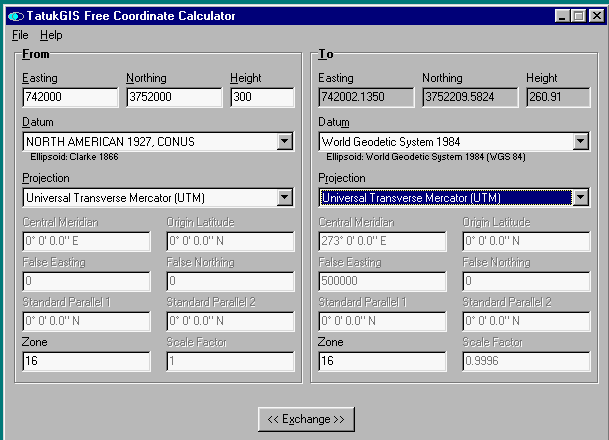
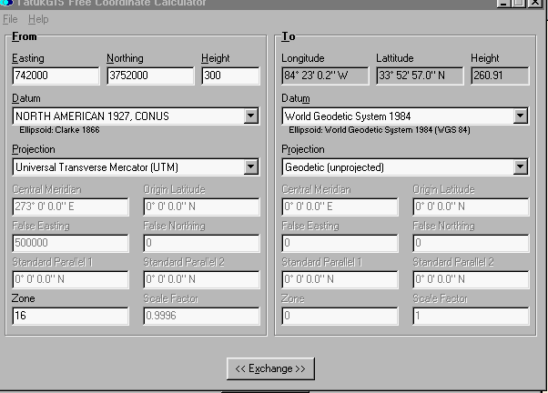
This calculator is being supplied courtesy of TatukGIS, the maker of a royalty-free GIS development toolkit and aerial imagery rectification software. The program provides converting between UTM, Long/Lat, and X,Y,Z coordinates with a large selection of datums and projections. There are MANY datums to choose from.
Description of Geodetic Coordinates:
Geodetic coordinates consist of geodetic latitude (f), geodetic
longitude (l), and geodetic height (h) which define the position of a point
on, or near, the surface of the earth with respect to a reference ellipsoid.
Their relationship to the reference ellipsoid is shown in the figure below.
The angle between the normal SP and the equatorial (X-Y) plane is called
the geodetic latitude (f) of point P. The meridian plane containing
point P is defined as the half-plane containing the Z-axis and point P.
The angle between the prime meridian (X-Z) plane and the meridian containing
point P is the geodetic longitude (l) of point P. Geodetic longitude
is not defined when P lies on the Z-axis. The distance from Q to
P is called the geodetic or ellipsoidal height (h).
Description of Geocentric Coordinates:
Geocentric coordinates are Cartesian coordinates (X, Y, Z) that
define the position of a point with respect to the center of mass of the
earth. The origin of the coordinate system is at the center of the
reference ellipsoid.
The coordinate system is a right-handed system, with the positive
X axis emerging from the ellipsoid at the equator on the prime meridian,
and the positive Z axis emerging from the ellipsoid at the north pole.
Tomasz
Kosinski